Saudi Arabia: Water Resources Network Modernization, 2013
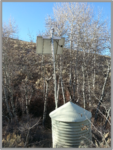
Summit Lake Paiute Reservation: Real-time monitoring equipment installation, 2013

Panama: Data Collection Software and Visualization Installation, 2013

Bhakra Beas Management Board Decision Support System for Satluj and Beas River Basins in the Himalaya Mountains of India
March-April 2009
I never even dreamed that I would visit the Himalaya, less work there. Now, I will work in the Himalaya over the next two years, taking six trips in total. The specific area is the eastern most tributaries of the Indus River which eventually flow through Pakistan. There are four river tributaries of the Indus River that flow through the Indian portion of the Himalaya. International accord provides that the water from the northern two tributaries of the Indus River that flow through the Himalaya of India would belong to Pakistan. The water from the southern two tributaries to the Indus River would belong to India. The Beas and Satluj Rivers, the two southern branches of the Indus River that flow through the Himalaya of India, is the focus of this project. The treaty allows India to use all of the water essentially letting no water from these two river flow into Pakistan, in exchange, India would not divert any water from the rivers that Pakistan. Being so close to a politically unstable Pakistan had me a bit concerned. As is often the case, I was well cared for by the people of the region, and there was sincere appreciation in having the assistance that I could provide.
My work was as an expert in data acquisition(which means the automation and delivery of water and weather information in real-time) as part of a team formed by the Danish Hydrological Institute (DHI), India. DHI was tasked with developing a decision support system. The decision support system will evaluate an enormous amount of data, some of which will come from the data acquisition system that I will be designing. The information will be subjected to further computations and factored into a set of rules. The result is a system that operates with great efficiency, thus saving the hydro-power operator millions of dollars over the years to come.
The area is immense, and the number of key measurement points (river level and precipitation) are numerous. We will also be designing the network for additional stations, including snow water content stations in the higher reaches of the Himalaya. My work here will be performed over the course of two to three years.
The following are images and thoughts that chronicle my first visit to the Himalaya.

| Design |
| Installation |
| Operation and Maintenance |
| Data Services |
| Current Projects |
| Past Projects |
| Adventures |
| Videos |
| Adventures-India-BBMB 2009 |
| Adventures - Jordan 2009 |
| Adventures- Rwanda, Africa 2008 |
| Adventures - Rwanda, Africa 2007 |
| Adventures - Colombia 2007 |
| Adventures - Australia I, 2004 |
| Bangladesh, 2012 |
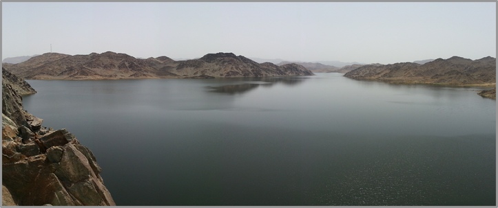
| Saudi Arabia, 2012 |
| SFWPA Video, 2010 |
| India Video, 2009 |
| Jordan Video, 2009 |
| Peru Video, 2009 |
| USBR Video, 2009 |
| Rwanda Video, 2008 |